Reachable - Travel Time Map iOS
See everything you can reach in the time you have

FreemiumiOS
- Upvotes
- 7
- Comments
- 0
- Impressions
- 244
this week
discussions
this week
About
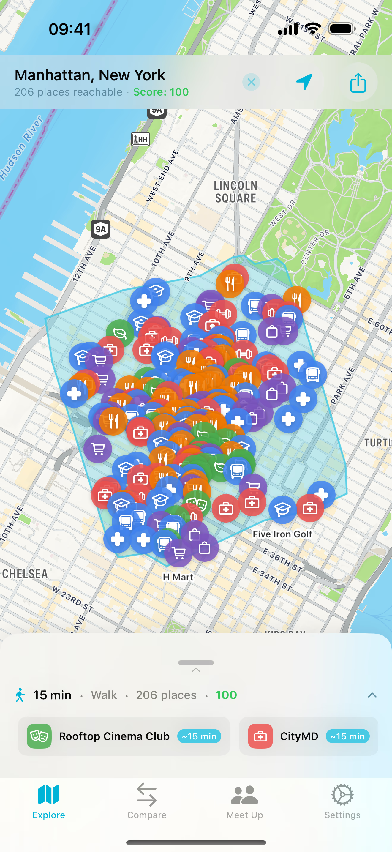
Reachable is an iOS and macOS map app that shows the real area you can get to within a chosen time, instead of using a simple distance radius. You tap a point on the map (or use your current GPS location), select a travel mode (walking, biking, or driving) and a time window, and the app draws an isochrone polygon using real road and path data. It then surfaces nearby places—such as restaurants, cafes, gyms, parks, shops, and other categories—and verifies each result is inside the reachable boundary. Reachable also includes tools to compare two locations side by side by counting reachable places in each category, and a “Meet Up” feature that lets a small group share a link, set their own starting points and travel budgets, and find the overlap area where everyone can meet, with place suggestions.
Problem & solution
Problem
People can't tell what places are truly reachable within a time limit.
Solution
Draws time-based reachable areas and lists verified places inside.
Who it's for
People planning travel, housing, meetups, and local errands.
Main features
- Isochrone polygon map
- Walk/bike/drive modes
- Place search & categories
- Compare two locations
- Group Meet Up overlap
Use cases
- Compare apartments by amenities
- Find meetup spots for a group
Comments
0 shownShare your thoughts about this tool.
Sign in to leave a comment.
No comments yet. Be the first to leave one.